As the southern spring of 2014 approached the search authorities prepared to undertake a search of the seabed where their calculations indicated the plane had gone.
They hired a Dutch marine survey company called Fugro, which dispatched three ships to the area: Fugro Discovery, Fugro Equator and Fugro Supporter.
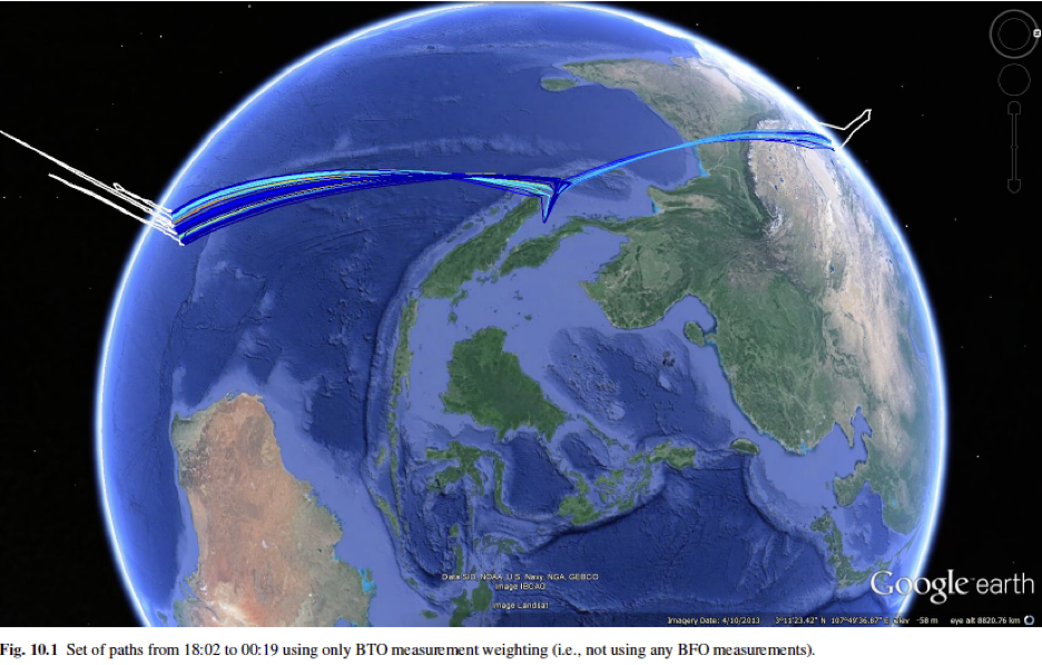
The area they were going to search had been defined by the probability density function we’ve described earlier. It stretched about 600 miles long and covered water that was about three miles deep.
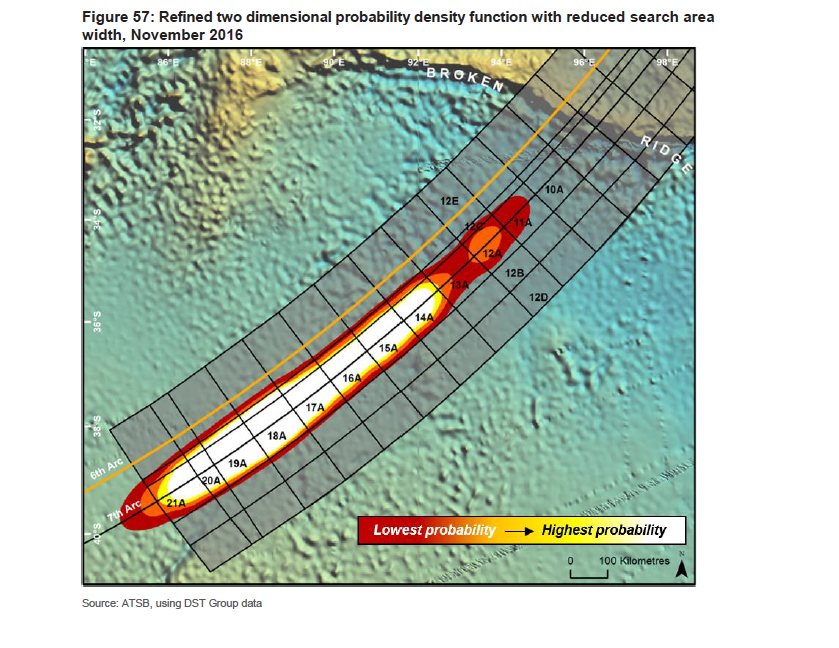
The logistical and technical challenges of searching this 23,000-square-mile area were enormous. Because it lay so far from land, crews would have to stay out for a month at a time, in a clime that mariners considered to be among the most inhospitable in the world. Here in the fabled “roaring forties” the waves at times reach 50 feet high.
Continue reading Deep Dive: MH370 Episode 15: Seabed Search